





The literature of the White Mountains, including natural history books, is vast. Rarely is a new book as groundbreaking as Michael Whittemore’s “Ecology of the New Hampshire’s 4000 Footers — A Natural History Trail Guide to the White Mountains and the Science that Shaped our Understanding,” …
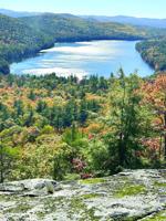
Often in the fall, as the peak of foliage moves south, I’ll often go to Bald Ledge (1,187 feet) in Porter. Maine. Although these foothills are low, the view south from the ledge out over the modest Colcord Pond, plus an 180-degree horizon of bumpy foothills, seems to embrace you as you enjoy…
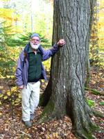
The Bowl Natural Area in the Sandwich Range is a good place to visit in the fall.

I used to have a saying about hard hikes. “What do you do the day after a hard hike?” The answer was: “A hard hike.” At 77, I don’t do that anymore. The day after a hard hike, I take it easy.
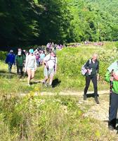
Jen’s Friends Climb Against Cancer happened this past Saturday at Mount Cranmore. Five hundred showed up for the event. Many climbed the mountain; others took the Skimobile Express chairlift to the summit.

The hike to Nancy Pond goes way back for me. Many years ago, I met New Yorker Carl Schildkraut on the trail. I left him and continued past the ponds, and climbed the trailless Mounts Lowell and Anderson. I sent him my column. Close to tears, he framed it and put it on his wall, and I’ve take…

CONWAY — The International Climbing School is holding its inaugural Rock Fest event this weekend (Sept. 18-20) in the White Mountains of New Hampshire. The event will incorporate rock climbing clinics, bouldering, live music, featured speaker presentations and an opportunity for connection.
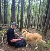
Last week I went on a 6-mile loop hike with friends Keats Myer and her husband, Demirhan Yenigun, from North Sandwich. They brought along their dog Gussie, a Chinook breed.

This summer, I led hikes for the World Fellowship Center in Albany. Every Tuesday morning, I would arrive for breakfast.

I wrote this column in the late fall of 2023. It is not often that I print a column that took place in another season. But I thought it might be the most effective way to convince people to head now over to Mount Cardigan, a beautiful peak in Orange and Alexandria. I haven’t been back since,…

Friday, Aug. 14, was a beautiful day. I didn’t get outside until late morning. I headed to Pinkham Notch Camp to hike the Old Jackson Road to Low’s Bald Spot.

Recently I was in Fryeburg, Maine, and did the 1.7-mile West Ridge Trail on Mount Tom (1, 073 feet).
On a hot Thursday this week, I headed over to the other side of the mountains and climbed Mount Pemigewassett (2,552 feet), also known as Indian Head. It was a good moderate choice, considering the heat.

Sometimes you are inspired to do a hike by seeing it from another location. Once I was sitting on the South Ledge viewpoint on Iron Mountain in Jackson. It is a dramatic place — you rest comfortably on smooth ledges with stunted pine and look west and southwest over many mountains. The next …
My friend Carl Schildkraut is up from New York. I've led him on hikes for many years. I'm meeting him today in North Conway for lunch.

This time of year is a good time to travel a distance for a unique hike. I did this hike a few years ago with an old friend who has since passed on.