





I used to have a saying about hard hikes. “What do you do the day after a hard hike?” The answer was: “A hard hike.” At 77, I don’t do that anymore. The day after a hard hike, I take it easy.
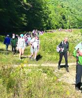
Jen’s Friends Climb Against Cancer happened this past Saturday at Mount Cranmore. Five hundred showed up for the event. Many climbed the mountain; others took the Skimobile Express chairlift to the summit.
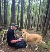
Last week I went on a 6-mile loop hike with friends Keats Myer and her husband, Demirhan Yenigun, from North Sandwich. They brought along their dog Gussie, a Chinook breed.

This summer, I led hikes for the World Fellowship Center in Albany. Every Tuesday morning, I would arrive for breakfast.

I wrote this column in the late fall of 2023. It is not often that I print a column that took place in another season. But I thought it might be the most effective way to convince people to head now over to Mount Cardigan, a beautiful peak in Orange and Alexandria. I haven’t been back since,…

Friday, Aug. 14, was a beautiful day. I didn’t get outside until late morning. I headed to Pinkham Notch Camp to hike the Old Jackson Road to Low’s Bald Spot.
On a hot Thursday this week, I headed over to the other side of the mountains and climbed Mount Pemigewassett (2,552 feet), also known as Indian Head. It was a good moderate choice, considering the heat.

Sometimes you are inspired to do a hike by seeing it from another location. Once I was sitting on the South Ledge viewpoint on Iron Mountain in Jackson. It is a dramatic place — you rest comfortably on smooth ledges with stunted pine and look west and southwest over many mountains. The next …
My friend Carl Schildkraut is up from New York. I've led him on hikes for many years. I'm meeting him today in North Conway for lunch.

This time of year is a good time to travel a distance for a unique hike. I did this hike a few years ago with an old friend who has since passed on.

The 2.5-mile Caps Ridge Trail to Mount Jefferson (5,716 feet) is a favorite for many hikers. Starting at 3,008 feet on the dirt Jefferson Notch Road, it requires less elevation gain than any other trail to reach a Presidential peak over 5,000 feet.
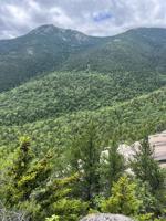
On a hot day this week I hiked to Carter Ledge, a unique bare granite ridgetop below Mount Chocorua and Middle Sister. This 5.6-mile, round-trip hike offers good exercise and spectacular views. That was why I went. The added bonus of a breeze from the west on top was welcome.
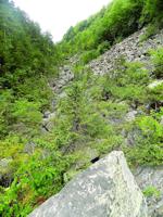
There is a hike in Randolph that you won't forget. The fact that I took it during the pandemic is interesting, maybe as therapy.

The 626-acre Chain of Ponds Community Forest in Madison is an exciting place in many ways. It is a place still being discovered.
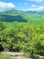
Thursday, I headed over to North Chatham and climbed Little Deer Hill (1,090 feet) and Big Deer Hill (1,367 feet), something I haven’t done in a few years. I am always glad when I do. Some small mountains have class, and these do.

The Dry River in the 27,000-acre Dry River Wilderness drains the southern side of Mount Washington from Oakes Gulf to the Saco River through a deep and narrow, steep-walled ravine. The 9.5-mile Dry River Trail runs along it from near Route 302 to the Crawford Path near Lakes of the Clouds Hut.