



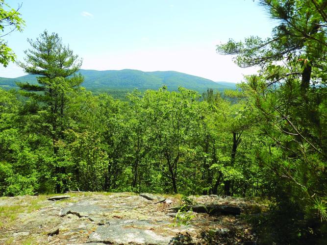
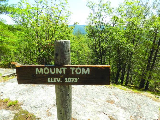

Recently I was in Fryeburg, Maine, and did the 1.7-mile West Ridge Trail on Mount Tom (1, 073 feet).
The round profile of Mount Tom, with a cliff on its south side, is visible on the left from Route 302 when you approach the bridge over the Saco River on your way east towards Bridgeton.
kAm %96C6 2C6 EH@ EC2:=D FA |@F?E %@>[ 3@E9 DE2CE:?8 @? |6?@E@>J #@25] %9:D C@25 :D =@42E65 @? E96 =67E @? #@FE6 b_a[ `]a >:=6D 62DE @7 E96 uCJ63FC8 !@DE ~77:46] k^Am
kAm %96 @=5 |@F?E %@> %C2:= 368:?D @? E96 C:89E :? a]b >:=6D 5@H? E96 C@25 7C@> #@FE6 b_a] xE A2DD6D E9C@F89 E96 AC@A6CEJ @7 E96 =@42= r2CE6C 72>:=J] %96 ?6H6C (6DE #:586 %C2:=[ 3F:=E 3J %96 }2EFC6 r@?D6CG2?4J[ 368:?D @? E96 C:89E `]` >:=6D 5@H? E96 C@25] |6?@E@>J #@25 :D 2 9:DE@C:42= 5625\6?5 C@25] pE @?6 E:>6 :E H2D E96 @=5 C@25 E@ qC:586E@?[ 2?5 2E :ED 6?5 H2D 2 “76CCJ” 24C@DD E96 $24@ #:G6C]k^Am
kAm x 92G6 366? FA E96 @=56C |@F?E %@> %C2:= 2 76H E:>6D :? E96 566A A2DE[ 2?5 H96? 2 7C:6?5 A@DE65 @? D@4:2= >65:2 23@FE E96 A=62DFC6 @7 9:<:?8 FA E96 ?6H (6DE #:586 %C2:=[ :E 8C23365 >J 2EE6?E:@?] k^Am
kAm %96C6 :D ?@E >F49 @7 2 G:6H 7C@> E96 DF>>:E @7 |@F?E %@>[ 8C@H? FA @G6C E96 J62CD[ 3FE >J 7C:6?5 D2:5 E92E E96 ?6H EC2:= 2D46?565 E9C@F89 2 362FE:7F= 7@C6DE H:E9 :?E6C6DE:?8 C@4< 7@C>2E:@?D] %9:D 4@?EC2DED H:E9 E96 @=5 |@F?E %@> %C2:=[ H9:49 :D H:56 2?5 2D46?5D A2DE D@>6 C6>2:?D @7 =2?5@H?6C =@88:?8 ?62C E96 3@EE@>] k^Am
kAm %96 }2EFC6 r@?D6CG2?4J @H?D E96 hhd\24C6 |@F?E %@> !C6D6CG6[ :?4=F5:?8 >@DE @7 E96 >@F?E2:? A=FD b[d__ 766E @7 7C@?E286 @? E96 $24@ #:G6C[ =@42E65 @? E96 @AA@D:E6 D:56 7C@> E96 EC2:=D]k^Am
kAm y@? q2:=6J :D E96 {2?5 |2?286C 7@C %96 }2EFC6 r@?D6CG2?4J’D $@FE96C? |2:?6 u:6=5 ~77:46] x? 23@FE a_`f[ 9:D 4C6H DE2CE65 E96 EH@\J62C AC@;64E @7 3F:=5:?8 E96 (6DE #:586 %C2:=] x?4=F565 :? E96 4C6H H6C6 :??6C 4:EJ J@FE9 7C@> “{6256CD :? t?G:C@?>6?E2= p4E:@? 7@C E96 uFEFC6[” @C {tpu]k^Am
kAm p=D@ AC6D6?E H6C6 }2EFC6 r@?D6CG2?4J G@=F?E66CD 2?5 DE277] “(6 6?;@J65 H@C<:?8 H:E9 E96 :??6C 4:EJ J@FE9[” D2:5 q2:=6J C646?E=J] “(6 H6C6 AC@F5 @7 H92E E96J 3F:=E] %96J H6C6 ?6H E@ E96 ?2EFC2= D46?6[ 2?5 6IAC6DD65 H@?56C :? :E] $@>6E:>6D H6 8@E 5@H? =2E6 27E6C 52C<[ 2?5 E96J 4@F=5?’E 36=:6G6 9@H 52C< :E 8@E :? E96 H@@5D[ 2?5 E96 2>@F?E @7 DE2CD :? E96 D<J 2E E96 EC2:=9625]”k^Am
kAm {2DE H66<[ x EFC?65 C:89E 2E E96 =2C86 D:8? :?E@ E96 EC2:=9625 A2C<:?8 =@E 2?5 962565 FA E96 EC2:=] p=>@DE :>>65:2E6=J[ x A2DD65 2 DEC:<:?8 46==2C 9@=6] p? `gdg >2A :?5:42E6D :E H2D =:<6=J E96 9@>6 @7 E96 p]w] tG2?D 72>:=J] xE >FDE 92G6 366? 2 =:G6=J A=246[ =@42E65 @? E96 @=5 C@25 E@ qC:586E@?]k^Am
kAm %96 ?2CC@H EC2:= H@F?5 E9C@F89 5:776C6?E 7@C6DE EJA6D 2D :E 2D46?565 E96 >@F?E2:?] pE E96 3@EE@> H6C6 >:I65 @2< 2?5 @E96C ?@CE96C? 92C5H@@5D] uFCE96C FA H6C6 36649 2?5 C65 A:?6[ 2?5 2E E96 E@A H2D 2? @2<^9:4<@CJ 7@C6DE H:E9 D42EE6C65 62DE6C? C65 4652CD]k^Am
kAm w2=7H2J FA H2D 2 DEC:<:?8 =@?8 =6586 H:E9 2 b_\7@@E 5C@A\@77] xE =@@<65 =:<6 2 >6E2>@CA9:4 C@4< H:E9 D65:>6?E2CJ =2J6CD DE:== G:D:3=6]k^Am
kAm %96 2EEC24E:G6 EC2:= H2D =2:5 @FE E@ 42FD6 >:?:>2= :>A24E E@ 7@C6DE 2?5 H:=5=:76[ @?6 @7 E96 }2EFC6 r@?D6CG2?4J’D 8@2=D] k^Am
kAm yFDE 36=@H E96 DF>>:E[ E96 EC2:= ;@:?65 E96 @=5 |@F?E %@> %C2:=] ~? E96 DF>>:E =6586D[ x A2DD65 E96 DF>>:E D:8? 2?5 H2=<65 5@H?9:== 2 76H 9F?5C65 766E 7FCE96C E@ 2 A2CE:2= G:6H @7 E96 =@?8 C:586 @7 !=62D2?E |@F?E2:? :? s6?>2C< :? E96 5:DE2?46[ 2?5 2E6 =F?49 :? E96 D9256]k^Am
kAm ~? E96 56D46?E[ x 4@F=5?’E C6D:DE E2<:?8 E96 @=5 EC2:= 5@H?[ E9@F89 x <?6H E96C6 H@F=5 36 2 `]a\>:=6 C@25 H2=< @? |65@E@>J #@25 324< E@ >J 42C] qFE E96 9:DE@C:42= C@25 :D ?@E 2 325 A=246 E@ H2=<]k^Am


(0) comments
Welcome to the discussion.
Log In
Keep it Clean. Please avoid obscene, vulgar, lewd, racist or sexually-oriented language.
PLEASE TURN OFF YOUR CAPS LOCK.
Don't Threaten. Threats of harming another person will not be tolerated.
Be Truthful. Don't knowingly lie about anyone or anything.
Be Nice. No racism, sexism or any sort of -ism that is degrading to another person.
Be Proactive. Use the 'Report' link on each comment to let us know of abusive posts.
Share with Us. We'd love to hear eyewitness accounts, the history behind an article.