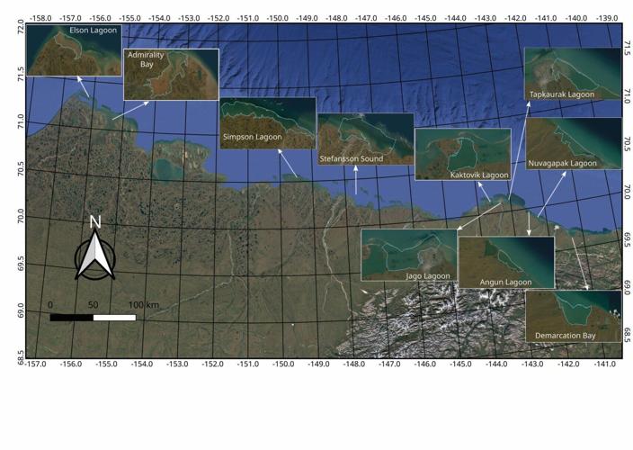
A satellite map of the Alaskan North Slope coastline highlighting various drainage basins and lagoons including Elson Lagoon, Simpson Lagoon, and Kaktovik Lagoon for permafrost research. (Mike Rawlins via SWNS)
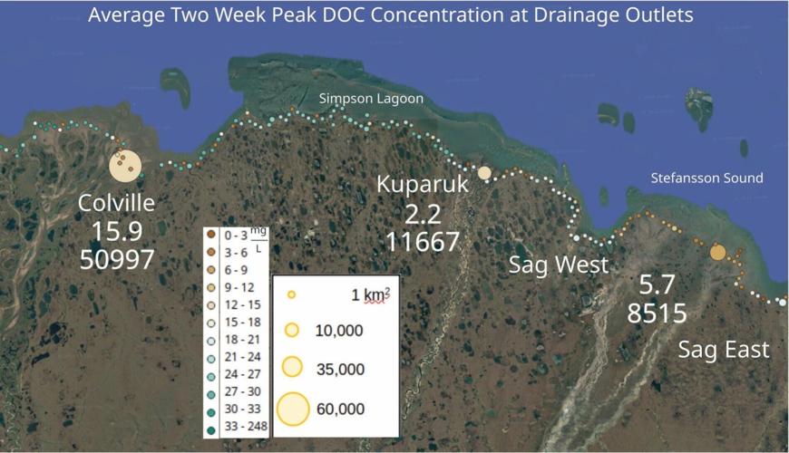
A scientific data map showing average peak dissolved organic carbon (DOC) concentrations at Alaskan drainage outlets like Colville and Kuparuk, using color-coded circles to represent milligrams per liter. (Mike Rawlins via SWNS)
A satellite map of the Alaskan North Slope coastline highlighting various drainage basins and lagoons including Elson Lagoon, Simpson Lagoon, and Kaktovik Lagoon for permafrost research. (Mike Rawlins via SWNS)
A scientific data map showing average peak dissolved organic carbon (DOC) concentrations at Alaskan drainage outlets like Colville and Kuparuk, using color-coded circles to represent milligrams per liter. (Mike Rawlins via SWNS)
Keep it Clean. Please avoid obscene, vulgar, lewd,
racist or sexually-oriented language. PLEASE TURN OFF YOUR CAPS LOCK. Don't Threaten. Threats of harming another
person will not be tolerated. Be Truthful. Don't knowingly lie about anyone
or anything. Be Nice. No racism, sexism or any sort of -ism
that is degrading to another person. Be Proactive. Use the 'Report' link on
each comment to let us know of abusive posts. Share with Us. We'd love to hear eyewitness
accounts, the history behind an article.


(0) comments
Welcome to the discussion.
Log In
Keep it Clean. Please avoid obscene, vulgar, lewd, racist or sexually-oriented language.
PLEASE TURN OFF YOUR CAPS LOCK.
Don't Threaten. Threats of harming another person will not be tolerated.
Be Truthful. Don't knowingly lie about anyone or anything.
Be Nice. No racism, sexism or any sort of -ism that is degrading to another person.
Be Proactive. Use the 'Report' link on each comment to let us know of abusive posts.
Share with Us. We'd love to hear eyewitness accounts, the history behind an article.