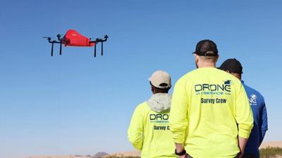
(BPT) - Drones have come a long way from capturing scenic photos and videos. Today's models fly farther and longer, carry heavy payloads, and can be equipped with LiDAR, multispectral, and thermal sensors that gather rich datasets in a single pass. They can uncover the precise data stakeholders need to support infrastructure projects at every step, from land-boundary detection and cadastral surveys to environmental monitoring and terrain modelling.
This flexibility, durability, and accuracy are fueling a drone service market that Fortune Business Insights projects will reach USD 261.32 billion by 2034. Deloitte's State of Digital Adoption in Construction 2026 confirms the trend: 34% of surveyed companies already use drones, with another 32% planning to add them soon. Drones are here to stay. The real question is who gets to use them.
Keep it Clean. Please avoid obscene, vulgar, lewd,
racist or sexually-oriented language. PLEASE TURN OFF YOUR CAPS LOCK. Don't Threaten. Threats of harming another
person will not be tolerated. Be Truthful. Don't knowingly lie about anyone
or anything. Be Nice. No racism, sexism or any sort of -ism
that is degrading to another person. Be Proactive. Use the 'Report' link on
each comment to let us know of abusive posts. Share with Us. We'd love to hear eyewitness
accounts, the history behind an article.







(0) comments
Welcome to the discussion.
Log In
Keep it Clean. Please avoid obscene, vulgar, lewd, racist or sexually-oriented language.
PLEASE TURN OFF YOUR CAPS LOCK.
Don't Threaten. Threats of harming another person will not be tolerated.
Be Truthful. Don't knowingly lie about anyone or anything.
Be Nice. No racism, sexism or any sort of -ism that is degrading to another person.
Be Proactive. Use the 'Report' link on each comment to let us know of abusive posts.
Share with Us. We'd love to hear eyewitness accounts, the history behind an article.