

The vinyl-like disc was recorded on the Mer de Glace in the French Alps and captures the real sounds of the glacier.
From
To

The Hektoria Glacier on Antarctica’s Eastern Peninsula retreated at an "unprecedented" rate in 2023.

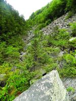
The Great Gulf on the northern side of Mount Washington is named well. Looking north from the top of its headwall, located near the Mount Wash…
Have you done a lot of 4,000 footers and consider the hardest part of hiking the vertical rise on roots and rocks? Try a different type of cha…
